Salzburg Glockner Tour via Felbertauern
Route details
Around 244 kilometers through three Austrian federal states with the Grossglockner High Alpine Road at its heart. A classic Alpine tour with high mountain passages, toll Scenic routes and views of Austria's highest peaks.
The Tour starts in Salzburg and first takes the B159 through the Salzach Valley to Golling. From there, the route continues south along the Pinzgauer Strasse. The first part of the route is mainly on well-maintained Main roads with moderate traffic.
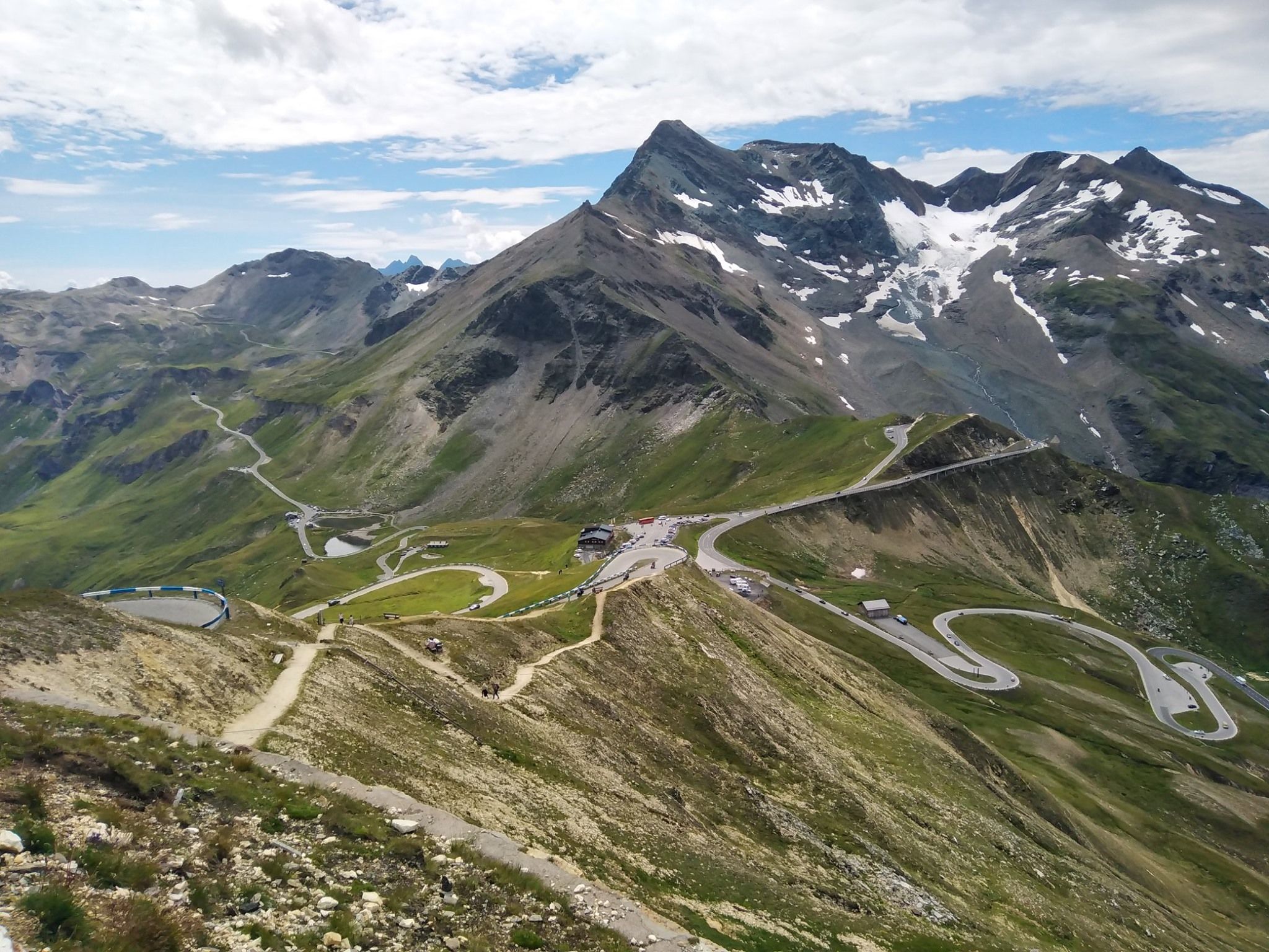
The highlight of the Tour is the Grossglockner High Alpine Road, one of the most famous high Alpine routes in Europe. The road connects the federal states of Salzburg and Carinthia and reaches its highest passable point at 2,571 meters on the Edelweissspitze. The road surface is very well constructed and material with maximum grip is used when the road is renewed. The regular sequence of hairpin bends with clear lines and a wide road surface enables rhythmic cornering. However, the ascent to the Edelweissspitze has cobblestones and requires safe handling of the motorcycle.
At the Kaiser-Franz-Josefs-Höhe at 2,369 meters, there is a direct view of the Grossglockner (3,798 m) and the Pasterze, the largest glacier in the Eastern Alps. Motorcyclists will find their own parking space and free bike safes for their equipment.
From Kals am Grossglockner in East Tyrol, the route continues north along the Felbertauern road. This toll road connects Matrei with Mittersill via the 5-kilometre Felbertauern Tunnel. The northern ramp has gradients of around 9 percent. The road is well developed and is also suitable for Alpine beginners.
The traffic volume on the Grossglockner High Alpine Road is seasonally high - in addition to motorcycles, there are also cars, coaches and vintage cars on the road. Early morning rides offer quieter conditions. Due to the altitude, the weather can change quickly; fog, wind or sudden drops in temperature can occur. In spring, temporary ice formation and motorcycle bans can occur in the morning due to melting water.
The toll for the Grossglockner High Alpine Road is around 33 euros for motorcycles (day pass). There is an additional Toll for the Felbertauern Road. There are combination tickets that cover both routes.
The total distance of around 244 kilometers can be covered in one day, whereby sufficient time should be planned for breaks and sightseeing. The roads are mostly in good to very good condition, although there may be isolated patches or older sections of road surface.
Start
Shell
Waypoint
Luegwinkl
Waypoint
Pinzgauer Straße
Waypoint
Großglockner Hochalpenstraße
Waypoint
Renates Würschdl Bude
Destination
Eni
Hyper-personalized tours for you and your style.
Create your own epic tours with our intuitive route planner. Select motorcycle, enter start, destination and waypoints and have your route calculated.


)