Provence-Ardèche: From Marseille to the bends
Route details
A route from the Mediterranean coast near Marseille via the Rhône valley up into the winding Mountain roads of the northern Ardèche. The route combines Mediterranean coastal landscapes with the wooded valleys of the Ardèche department.
The Tour begins in the north of Marseille and first leads through the Étang landscape near Saint-Mitre-les-Remparts. This first section is still relatively flat through the Provençal coastal plain with its characteristic salt lakes and lagoons. At Rognonas, the route crosses the Durance over a suspension bridge and soon reaches the Rhône valley.
From La Voulte-sur-Rhône, the character of the Tour changes fundamentally. The small town lies at the entrance to the Vallée de l'Eyrieux and marks the transition from the wide Rhône valley to the narrower river valleys of the Ardèche. The town itself offers cultural and historical substance with its château dating from the 13th to 17th centuries and the remains of a historic ironworks.
From here, the Route leads into the mountains of the Monts d'Ardèche Regional Nature Park. The section via Saint-Sauveur-de-Montagut through the Vallée de l'Eyrieux is characterized by tight bends and changing Elevation profiles. The valley is heavily wooded, with chestnut forests dominating the landscape. The roads are mostly well asphalted, but narrow in places and without a central reservation.
At Saint-Julien-d'Intres, the Tour reaches an altitude of around 900 meters before descending again via Désaignes. Désaignes is a medieval village with well-preserved town walls, three historic town gates and a fortress from the 12th century. The village bears the label "Village de Caractère" and features well-preserved stone houses made from local materials.
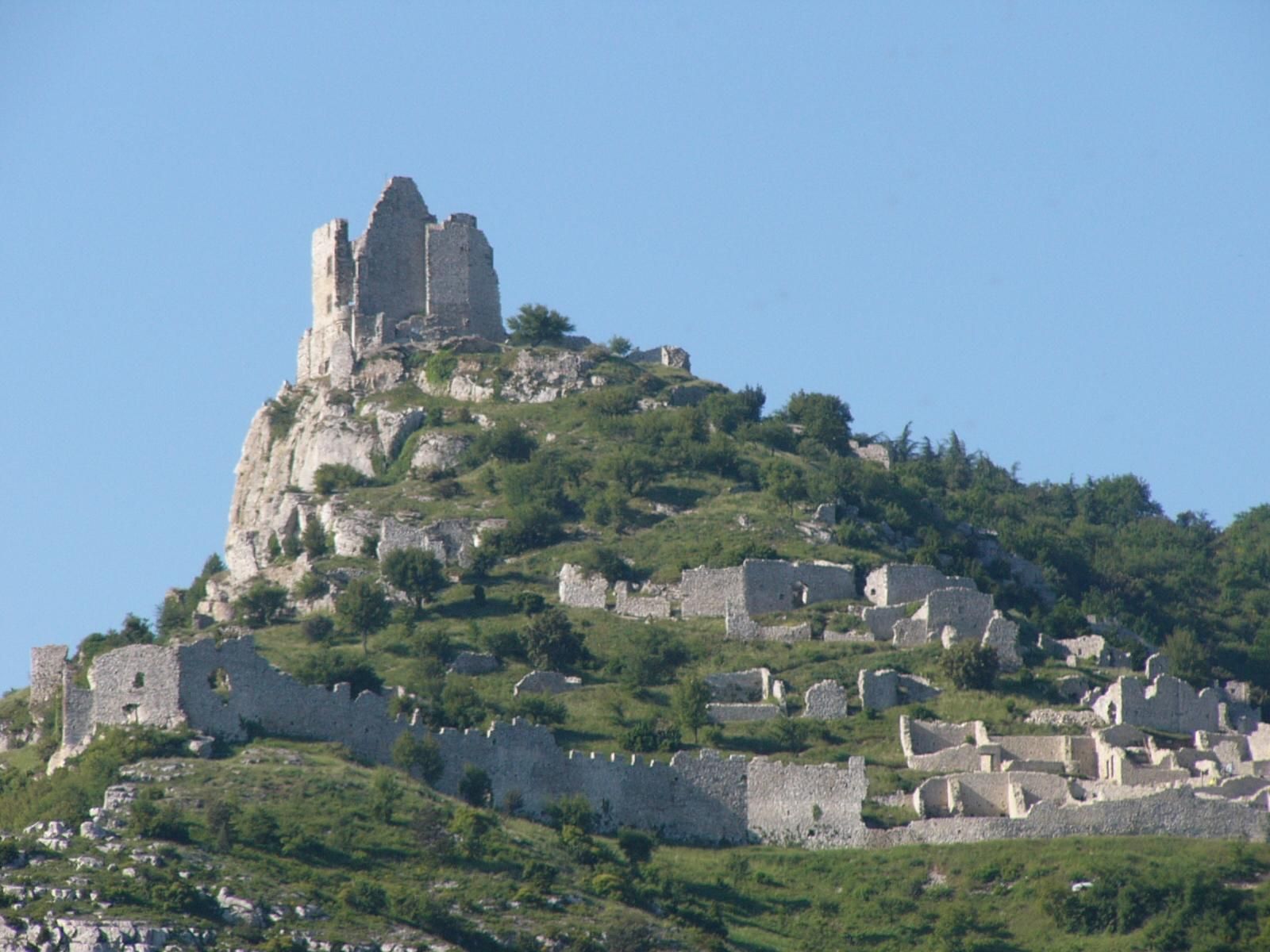
The end point of the Tour is at Saint-Péray in the northern Rhône valley. Above the village, the ruins of Crussol Castle from the 12th century are perched on a limestone cliff more than 200 meters above the valley floor. The view extends across the Rhône valley as far as Valence.
The route is interesting for motorcyclists because of the combination of different road types: flat overland stretches in the south, winding Mountain roads in the Ardèche with Switchbacks and sometimes tight bends. Traffic on the secondary roads in the mountains is light outside the main season. The Ardèche is known among motorcyclists as a region with good grip asphalt and a variety of bends. The Tour requires attention due to the occasional blind Curves and occasional road damage at higher altitudes.
Start
TotalEnergies
Waypoint
Route des Étangs
Waypoint
Pont suspendu de Rognonas
Waypoint
Quai Anatole France
Waypoint
Mouron
Waypoint
Ruisseau de l'Allée
Waypoint
Chemin du Vernet
Destination
Avia
Hyper-personalized tours for you and your style.
Create your own epic tours with our intuitive route planner. Select motorcycle, enter start, destination and waypoints and have your route calculated.


)