Côte d'Azur hinterland tour via Estérel
Route details
Round trip from Monaco via the Corniche d'Or, through the hinterland of the Préalpes d'Azur and back to the coast. 351 km between the Mediterranean and the foothills of the Alps with varied route characters.
This 351-kilometre round trip connects the coastal roads of the Côte d'Azur with the mountainous hinterland of the Maritime Alps and offers a marked contrast between Mediterranean coastal flair and pre-alpine landscape.
The start is at Cap-d'Ail near Monaco. The first Stage leads westwards via the Corniche near Nice to Cannes. This section is mainly on well-maintained coastal roads with a moderate number of bends. In Cannes and Nice, you can expect an increased volume of traffic, especially in the high season.
From Saint-Raphaël, the Route follows the Corniche d'Or along the Massif de l'Estérel. This coastal road, built in 1903 by the Touring Club de France, is considered one of the most impressive routes in the south of France. The red porphyry cliffs of the Estérel mountains form a striking contrast to the turquoise Mediterranean. The road winds through numerous Curves and offers several Viewpoints to stop at. The road surface is mostly good, but has been damaged in places by salt air and the weather.
At Peyroules, the route leaves the coast and climbs into the hinterland. The Waypoint is located on the edge of the Gorges du Verdon Nature Park at an altitude of around 1,000 meters. The roads become much narrower and more winding here. The landscape changes from Mediterranean vegetation to pre-alpine coniferous forests and barren plateaus.
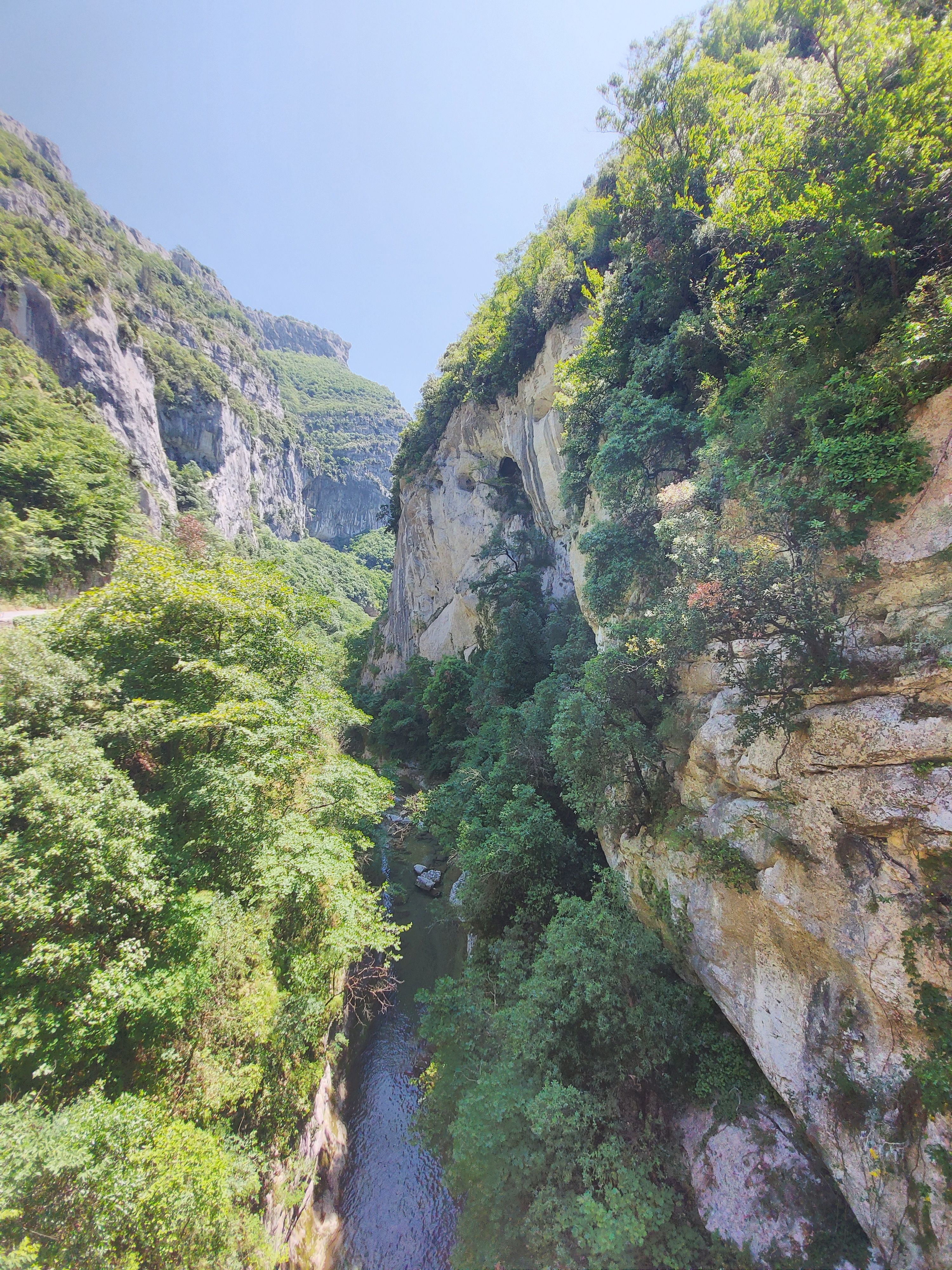
Via Gilette and the D17 towards Roquesteron, the Tour crosses the Parc naturel régional des Préalpes d'Azur. This region is sparsely populated and offers quiet side roads with little traffic. The route includes several smaller Mountain passes and valley crossings with corresponding changes in altitude. Some of the roads are narrow and require careful driving, especially when there is oncoming traffic.
The way back to Monaco leads through the Var valley and over the foothills of the Maritime Alps. The last few kilometers to Monaco again involve urban traffic.
The road surface varies along the route: mostly good to very good on the coast, in the hinterland with patches in places and showing its age. The Tour is suitable for riders with solid experience on Mountain roads. The total difference in altitude and the changing road characteristics require attention, but are not extremely technically demanding.
Start
Total
Waypoint
Corniche André de Joly
Waypoint
Avenue du Maréchal Juin
Waypoint
Route des Escalles
Waypoint
Route de la Corniche
Waypoint
Rue de Chauvet
Waypoint
Route de Roquesteron
Destination
Avenue Princesse Grace
Hyper-personalized tours for you and your style.
Create your own epic tours with our intuitive route planner. Select motorcycle, enter start, destination and waypoints and have your route calculated.


)