Col de l'Iseran Tour Tarentaise
Route details
A 269 km Round trip through the Tarentaise Valley with the Col de l'Iseran, the highest asphalted Alpine pass. The route takes in shares of the Route des Grandes Alpes through the heart of the Savoy Alps.
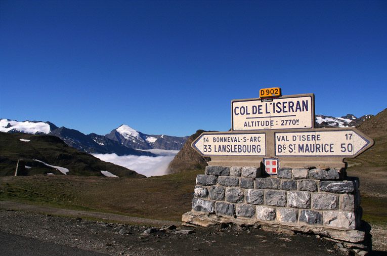
The Tourer starts in Aiton in the Isère valley and first heads south via Moûtiers to Fourneaux. From there, the real highlight begins: the ascent to the Col de l'Iseran via Val-d'Isère. At 2,764 meters, the Iseran is the highest passable asphalted mountain pass in the Alps. The road is part of the legendary Route des Grandes Alpes and is only open from around mid-June to mid-October.
The northern ramp from Val-d'Isère is a masterpiece of road construction: a steady ascent, around 8 Hairpins and optimal use of the terrain. The road surface is asphalted throughout and mostly well developed, although there are no road markings in places at the Pass summit. The Curves are largely sweeping and smooth to ride. In the upper section, you pass through several galleries and tunnels - caution is advised here in Wet conditions.
The massive Iseran Chapel made of natural stone stands at the summit in the middle of the barren high mountain landscape. A short stop is worthwhile for the panoramic view of rugged peaks and the remnants of snow that are still present in midsummer. The infrastructure is limited to a small restaurant.
The descent is via Séez back towards Bourg-Saint-Maurice. The Route passes the Lac du Chevril, a reservoir with a 180-metre-high arched dam wall, on which a famous Heracles fresco can be seen. The route along the lake leads through several galleries.
The loop closes via the Tunnel de la Saucette near Moûtiers. The way back to Aiton is on well-maintained roads through the Isère valley.
In terms of traffic, the route is busier in the high season (July/August), as both motorcyclists and cyclists use the route. During the week and in the early morning, the volume of traffic is significantly lower. Overall, the Tourer is not overly technically demanding, but requires concentration when adjusting to the altitude and in the galleries. The altitude of almost 2,800 meters can bring low temperatures even in summer - appropriate clothing is advisable.
The total distance of 269 kilometers can be comfortably covered in one day, whereby sufficient time should be planned for breaks and photo stops.
Start
Route d'Albertville
Waypoint
Avenue de la Liberté
Waypoint
Avenue du Prariond
Waypoint
Le Belvédère
Waypoint
Tunnel de la Saucette
Destination
Route d'Albertville
Hyper-personalized tours for you and your style.
Create your own epic tours with our intuitive route planner. Select motorcycle, enter start, destination and waypoints and have your route calculated.


)