Anaga Mountains: laurel forests and north coast
Route details
Round trip through the UNESCO Anaga Biosphere Reserve in the north-east of Tenerife. The Tour leads along winding Mountain roads through primeval laurel forests, past Viewpoints and traditional villages.
The approximately 76-kilometre round trip starts at Playa de Tahodio near Santa Cruz de Tenerife and first heads north along the Autovía de San Andrés. From San Andrés, the ascent into the Anaga Mountains begins via the TF-12, one of the island's characteristic Mountain roads.
The Anaga Mountains have been a UNESCO biosphere reserve since 2015 and are considered one of the oldest parts of Tenerife. The peninsula stretches for around 20 kilometers in length and up to 10 kilometers in width. The main ridge reaches an altitude of just over 1,000 meters. The region is known for its cloud forests - relics from the Tertiary period that are unique in Europe. The trade winds ensure sufficient humidity, which is why lush laurel forests thrive here.
The road layout is challenging: tight curves, gradients of around six to eight percent and narrow lanes in places characterize the road. The TF-12, also known as the Anaga High Road, runs directly along the main ridge from west to east and has a good two-lane layout. There are passing bays at narrow points. The asphalt is mostly in good condition, but after rainfall, sandy alluvial deposits or damp patches can affect the ideal route. There is often Fog in the ridge area, which can considerably restrict visibility.
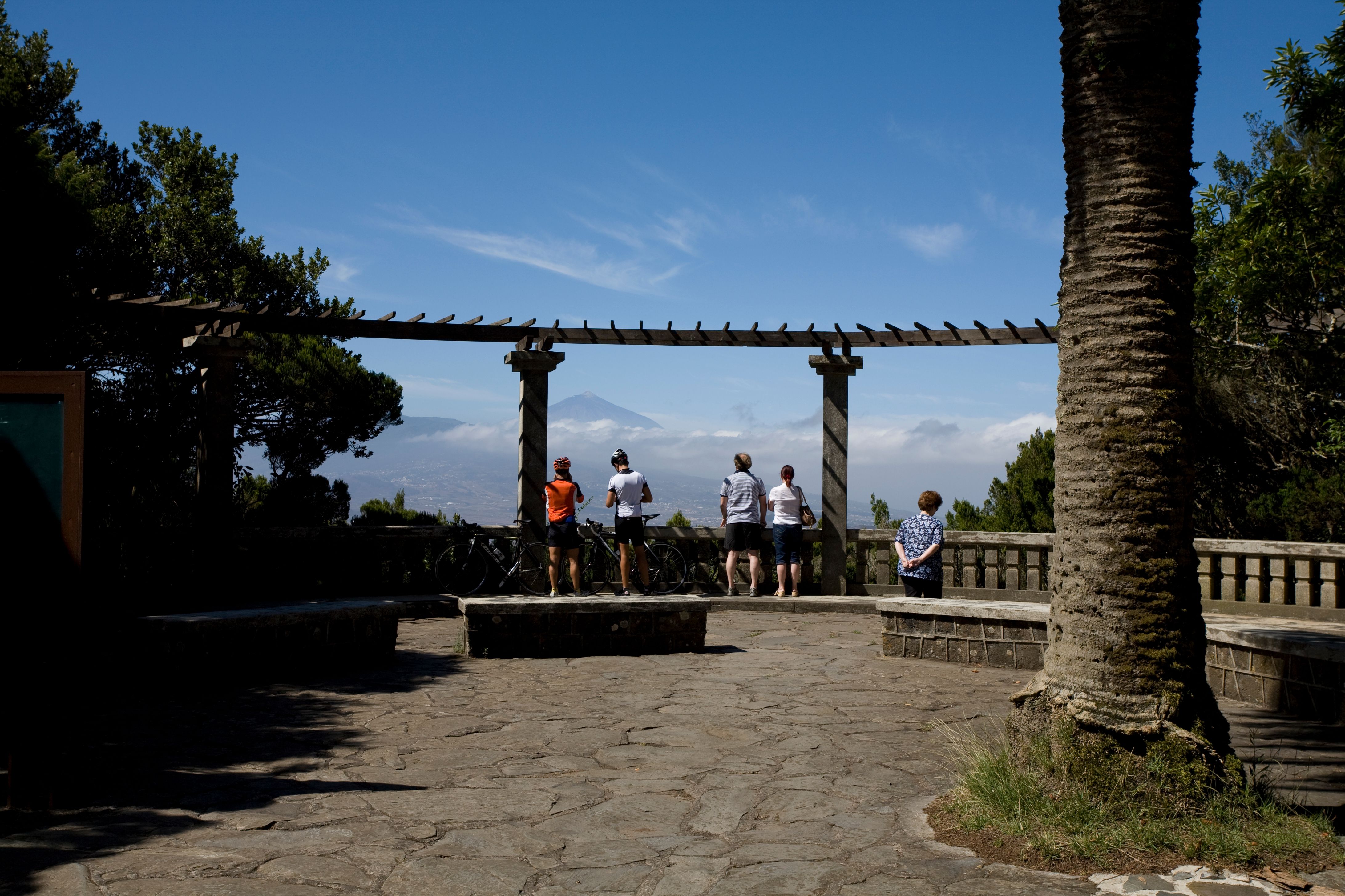
The route passes several viewpoints (miradores), including the Cruz del Carmen at an altitude of around 920 meters. On a clear day, you can enjoy a panoramic view of La Laguna and Mount Teide from here. There is also a visitor center at the Mirador with information about the nature park.
The route continues via Las Mercedes to San Cristóbal de La Laguna, the former capital of the island. The old town was declared a UNESCO World Heritage Site in 1999 - the first unfortified colonial city whose urban plan served as a model for many Latin American cities.
From La Laguna, the route runs via Tacoronte and Llano del Moro back to Santa Cruz. Tacoronte is known for its wine culture and traditional Canarian gastronomy. The region has a protected designation of origin for wines.
In terms of traffic, you can expect it to be busier at weekends and at lunchtime, as both locals and tourists drive to the viewpoints. The route is quieter during the week and in the early morning. Temperatures can be significantly cooler in the ridge area than on the coast - a difference of ten degrees is possible. A wind and rainproof jacket is recommended.
Start
Playa de Tahodio
Waypoint
Autovía de San Andrés
Waypoint
Carretera Norte San Andrés-Las Mercedes
Waypoint
PR-TF 2
Waypoint
El Cementerio
Waypoint
El Cardumen
Waypoint
Llano del Moro
Destination
Auditorio y Centro de Ferias y Congresos
Hyper-personalized tours for you and your style.
Create your own epic tours with our intuitive route planner. Select motorcycle, enter start, destination and waypoints and have your route calculated.


)